
Proposed Bundaleer Greenway
The Heysen and Mawson Trails were established in the Bundaleer Forest in the late 1980s/early 1990s. Trail infrastructure also includes the Curnow’s Hut which is used for overnight accommodation and camping by trails users. The Heysen Trail is managed by DEWNR with support from the Friends of the Heysen Trail and Other Walking Trails and the Mawson Trail is managed by DPTI/Office for Recreation and Sport.
As part of the Mid North Forests Future Strategy a process has been initiated to protect the Heysen and Mawson Trails and related infrastructure under the Recreational Greenways Act 2000.
It is proposed that the Heysen and/or Mawson Trails be realigned to form the Bundaleer Greenway to include sections of the existing forest trails, heritage buildings and sites, accommodation and camping sites and community art.
We acknowledge the significant amount of feedback that we have received from the community in relation to the Bundaleer picnic grounds and surrounding trails.
Please be assured that the key issues that have been raised on these pages in relation to the Bundaleer picnic grounds, trails beyond the existing Mawson and Heysen trails (in both forests) and issues relating to Greenways and Public Liability Insurance are acknowledged. They have been noted and will be considered by the project team upon the consultation period closing on Monday 12 June 2017.
Proposed Bundaleer Forest Greenway:
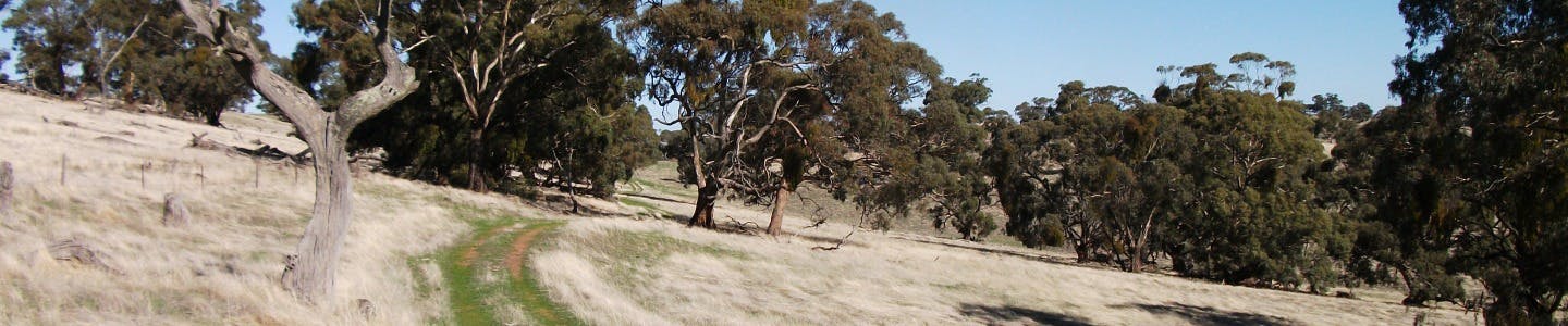
Located in the Bundaleer Forest, Hundreds of Belalie and Yangya, South Australia, the proposed greenway comprises three portions as described below:
PORTION A: Commencing at the intersection of Springs Road, Bundaleer Gardens and the Heysen Trail, thence following internal forest trails generally westerly to Curnows Hut, thence generally northerly, westerly, northerly and easterly to Neindorf Road, Bundaleer Gardens.
PORTION B: Commencing at the Bundaleer Picnic Ground, Bundaleer North, thence following internal forest trails generally northerly and westerly to Conservators Hut, thence generally westerly, northerly, westerly and southerly to the intersection of Brown Track and Bore Track, Bundaleer North.
PORTION C: Commencing at the Bundaleer Picnic Ground, Bundaleer North, thence following internal forest trails generally northerly, westerly northerly and westerly to Range Road, Bundaleer North in the vicinity of the Bundaleer Golf Course.
Uses: The intended public use of the proposed Bundaleer Forest Greenway portions A & B above will be limited to recreational walking only and the intended public use of the proposed Bundaleer Forest Greenway portion C above will be limited to recreational walking and cycling only.
Maps: Click here to see maps describing the proclaimed Greenways routes.
The proposed Bundaleer Greenway portions A and B (which encompasses sections of the Heysen Trail) would include the following features::
- Curnow’s Hut
- A new section of trail linking Curnow’s Hut and the Bundaleer Picnic Ground using existing fire tracks
- Bundaleer Picnic Ground
- A section of the Sculpture Trail
- Foresters House Ruin
- A section of the Scenic Trail
- The Old Forest Office (State Heritage Listed Building)
- The section of the Conservator's Trail between the Picnic Ground and the Conservator's Hut
- The Seeds Beds (State Heritage listed site)
- Conservator's Hut
- The eastern and northern section of the Conservator's Trail including the lookout
- The Bundaleer Arboretum
- A new section of trail using existing firebreaks between the arboretum and New Campbell Hill.
The proposed Bundaleer Greenway Portion C (which encompasses sections of the Mawson Trail) located in the northern part of the forest, also requires protection and this greenway is proposed to include the southern section of the Conservator’s Trail, which would give cyclists access to Conservator’s Hut and effectively retain all of the current access to the trail, known as the Conservator’s Trail.
Proposed Bundaleer Greenway
Heysen Trail
Summary Description
From Curnow’s Hut the trail heads in a northerly direction and follows a series of named and unnamed fire tracks, two short sections of fence line and a section of the Maple Walk until it reaches the Bundaleer Picnic Ground. From the Bundaleer Picnic Ground it follows the Sculpture Trail and a section of the Conservator’s Trail, past the Conservator’s Hut and onto a section of the Conservator’s Track until it meets Neindorf Road where it connects onto the current alignment of the Mawson Trail. It then follows the Mawson Trail to the Booyoolie Track. It then follows sections of the Booyoolie, Johnston and Brown Tracks until it exits the forest on the western boundary.
Detailed Description
PORTION A
From the vicinity of Never Never Creek and Springs Road, the Heysen Trail heads towards Curnow’s Hut. It then follows unnamed fire tracks in a northerly direction to the junction of Bore Track. It then follows Bore Track to the west and then turns north along Orchard Track. It follows Orchard Track for a short distance then turns west and follows unnamed fire tracks around the edge of pine and sugar gum plantations. It then crosses over a fence and runs along the boundary of a PIRSA – Farm Forestry Demonstration Site (Mixed Eucalypt Seed Orchard) until it joins with Catalpa Track. It then follows downhill in a north easterly direction where it turns to the east and follows a fence line for a short distance until it meets Neindorf Road.
PORTION B
From the Bundaleer Picnic ground the trail follows the Conservator’s Trail past Bundaleer Cottage and seed beds (State Heritage Listed) to Conservator’s Hut.
From Conservator’s Hut the trail follows an unnamed track to the scenic lookout which features a stone wall and community art installation made from recycled fencing wire. The trail then follows the north edge of the Conservator’s Trail until it meets the Conservator’s Track. It crosses a fence then heads in a westerly direction for a short distance until it meets the Mawson Trail. It then follows the route of the Mawson Trail in a north easterly direction until it meets Booyoolie Track. The trail crosses a fence then heads in a north westerly direction uphill on a fairly undefined track until it meets Johnston Track were excellent views to the north and west can be seen. The trail heads south along Johnston Track until it meets Neindorf Road. It crosses Neindorf Road and a fence and re-enters the forest. The trail follows Brown Track through a plantation of very old pine and then follows a ridge track which passes through and adjacent to an old stone wall with excellent views in all directions until it meets the existing Heysen Trail and exits the forest and heads west to Georgetown.
Mawson Trail
Summary Description
From the junction of the Bundaleer Picnic Ground and Springs Road it follows sections of the Conservator’s Trail, past Conservator’s Hut and onto a section of the Conservator’s Track until it meets Neindorf Road where it connects back onto the current alignment of the Mawson Trail.
Detailed Description
PORTION C
From the junction of the Bundaleer Picnic Ground and Springs Road it follows sections of the Conservator’s Trail. The trail follows the southern edge of the Conservator’s Trail along the Conservator’s Track past the Bundaleer Arboretum until it meets Neindorf Road and then follows the current alignment of the Mawson Trail in a northerly direction.
Consultation has concluded

