
Sellicks Beach Growth Area Joint Amendment
Consultation has concluded
Find out about the state government's proposal to rezone land at Sellicks Beach for future housing and amend the Greater Adelaide Regional Plan through a Joint Amendment.
What's being decided?
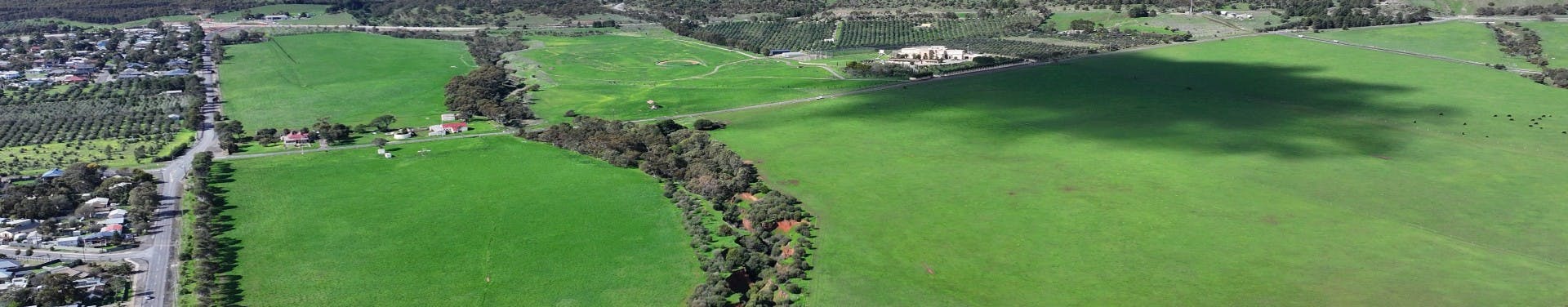
The Sellicks Beach Growth Area Joint Amendment aims to rezone approximately 134 hectares of land (the Sellicks Beach Growth Area) in Sellicks Beach to help facilitate the staged development of a new master planned community that could accommodate about 1,700 new homes. The Affected Area map shows the area that is proposed to be rezoned.
The Joint Amendment proposes the following changes to the planning rules in the affected area:
- rezoning approximately:
- 134 hectares of land currently in the Deferred Urban and Rural Zones to the Master Planned Neighbourhood Zone, a zone that would support the creation of a new community, with a range of housing that supports diverse needs and lifestyles, located within easy reach of services, with new roads, facilities and open space.
- applying a new Emerging Main Street Subzone across the affected area to support:
- a new activity centre that enables the development of employment and community services, such as a supermarket. The subzone seeks a main street that is a focal point for the surrounding neighbourhood and encourages pedestrian activity
- a focus on housing density around the activity centre to promote walkable neighbourhoods.
- applying a new Coordinated Development Overlay across the affected area, which acts as a holding mechanism to defer urban development until air quality monitoring and assessment is complete and infrastructure agreements are in place.
- applying the Urban Tree Canopy Overlay across the affected area to encourage tree planting with new development.
- applying the Affordable Housing Overlay across the affected area to deliver at least 15 per cent affordable housing with new residential development
A Concept Plan for Land Use for the affected area has been developed to show where the activity centre/shops could be located, as well as identifying landscape buffers and shared use paths.
The Joint Amendment also seeks to amend the Greater Adelaide Regional Plan to include a new recommendation that enables the removal of the holding overlay, to allow the land to be developed for housing, once the air quality monitoring program is complete, with findings which support development in the Affected Area, and an infrastructure scheme/agreement is in place.
Consultation on the Joint Amendment closes on 16 October 2025.
Infrastructure approach
A Basic Infrastructure Scheme (the Scheme) will be developed to ensure the infrastructure needed to support future growth in Sellicks Beach is well understood and planned for.
Infrastructure schemes create a coordinated delivery mechanism for basic infrastructure such as roads, intersections and bridges and stormwater management, and may include services such as water, wastewater and electricity.
The scheme will be developed between local government, landowners, utility providers and state government agencies and will set out the infrastructure required, when it will be delivered and the funding arrangement to ensure infrastructure is available in line with development of the land.
The delivery of social infrastructure, such as recreation and other community facilities and services will be negotiated with council.
A Concept Plan for Basic Infrastructure for the affected area identifies essential infrastructure such as roads and stormwater.
Background
The Sellicks Beach Growth Area Joint Amendment is part of the South Australian Government’s Housing Roadmap delivering more residential land allotments to market and providing more affordable homes for South Australians.
The Greater Adelaide Regional Plan, adopted in March 2025, also identifies Sellicks Beach as an area for strategic growth.
Residential land supply in southern Adelaide is currently constrained, with nearly all areas available for growth either under active development or in the process of being released to market.
The Sellicks Beach Growth Area Joint Amendment is seeking to address an immediate need for further land supply to address future population growth and meet the demand for new housing in the Outer South region of Greater Adelaide.
The rezoning of land at Sellicks Beach is also being considered because:
- the area presents a logical expansion of the existing urban area with direct linkages to a residential development located directly to the west and north
- the location being well serviced by existing road infrastructure and bus routes
- the location being well serviced by existing social infrastructure and employment – including schools, nearby district centre, emergency services, and community facilities.
Get involved
Find out more
- Read the What we heard summary of feedback received
- Read the draft Sellicks Beach Growth Area Joint Amendment
- View the Concept Plan for Land Use
- View the Concept Plan for Basic Infrastructure for the affected area
- Take a look at our comprehensive frequently asked questions (FAQs)
- Read our Environment Fact Sheet to find out about how the environment has been considered
- Read our Infrastructure Schemes for Growth Areas - Sellicks Beach Fact Sheet
- See our Complying Changes to the Planning and Design Code Fact Sheet
- View materials about air quality monitoring on PlanSA
- Visit the PlanSA website
- Ask a question via the PlanSA Service Desk, email: PlanSA@sa.gov.au
Have your say
- Email: plansasubmissions@sa.gov.au (subject: Submission – Sellicks Beach Growth Area Joint Amendment)
- Post: Code Amendment Team, Department for Housing and Urban Development
GPO Box 1815
ADELAIDE SA 5001 - Make a submission with the PlanSA submission form
What are the next steps?
We will consider your feedback to finalise the draft Sellicks Beach Growth Area Joint Amendment.
We will prepare an engagement report outlining what we heard during consultation and how the feedback was considered.
We will provide the draft Joint Amendment and engagement report to the Minister for Planning for his consideration and will publish the finalised Joint Amendment and engagement report on the PlanSA website.
We will publish submissions as part of the engagement report, including company details, but personal addresses, email addresses or phone numbers will not be published.
Documents
-
 What we heard feedback summary - Sellicks Beach Growth Area Joint Amendment.pdf (242 KB) (pdf)
-
Sellicks Beach Affected Area map.pdf (1.4 MB) (pdf)
-
Frequently_Asked_Questions_-_Sellicks_Beach_Growth_Area_Joint_Amendment.pdf (390 KB) (pdf)
-
Fact-Sheet-Environment - Sellicks Beach Growth Area Joint Amendment (118 KB) (pdf)
-
Fact-Sheet-on-infrastructure-schemes-for-growth-areas - Sellicks_Beach (202 KB) (pdf)
-
Fact-Sheet-Complying-changes-to-the-Planning-and-Design-Code.pdf (180 KB) (pdf)
-
Draft-for-Consultation - Sellicks Beach Growth Area Joint Amendment (3.78 MB) (PDF)
-
Concept-Plan-163-Sellicks-Beach-Land-Use (920 KB) (PDF)
-
Concept-Plan-164-Sellicks-Beach-Basic-Infrastructure (987 KB) (pdf)
-
Attachment-E1-Draft-Structure-Plan (19.6 MB) (PDF)
-
Attachment-E2-Air-Quality-Monitoring-and-Assessment (945 KB) (PDF)
-
Attachment-E3-Environmental-Noise-Quality-Assessment (2.44 MB) (PDF)
-
Attachment-E4-Stormwater-Management (5.92 MB) (PDF)
-
Attachment-E5-Traffic-Assessment (5.86 MB) (PDF)
-
Attachment-E6-Social-Infrastructure-Analysis (5.44 MB) (PDF)
-
Attachment-E7-Retail-Analysis (1.72 MB) (PDF)
-
Attachment-E8-Ecological-Assessment (7.56 MB) (PDF)
-
Attachment-E9-Preliminary-Tree-Assessment (9.25 MB) (PDF)
-
Attachment-E10-Preliminary-Site-Investigation-Part-1 (46.6 MB) (pdf)
-
Attachment-E10-Preliminary-Site-Investigation-Part-2 (33.7 MB) (pdf)
-
Sellicks Beach Joint Amendment Engagement Report (8.51 MB) (pdf)
